18 Aug, 2007, Davion wrote in the 22nd comment:
Kelvin said:
We've got a filterable, automatically generated map with color-coded objectives and warps.
It really is necessary for our kind of game, where the entire thing is played on a 3D coordinate-based plane. You really need to be able to see the big picture.
It really is necessary for our kind of game, where the entire thing is played on a 3D coordinate-based plane. You really need to be able to see the big picture.
That's pretty cool Kelvin! IIRC, you also set it up so players could have their stats in a banner, and it'd auto update them as they advanced! I thought that was really cool.
18 Aug, 2007, Kelvin wrote in the 23rd comment:
Yeah, forum banner sigs, which are also pretty easy to do:

18 Aug, 2007, Conner wrote in the 24th comment:
Darmond said:
mmmm I am jelous wish I could show off my own map now but its kinda hanging on my wall *sighs* I wounder if I still have that 1 pice left that I spent a month on lol I am not a fast artist sadly I will look for it though see if I can dig it up
Our map started out with a player making us the nice "plain" green/blue one and then Dragona freehand copied it to a bunch of sheets of printer paper that we thumbtacked to a 4'x5' cork board that still sits between our desks with push pins holding "flags" in place for each of our areas. The color coded version that Hades used to prettify the "plain" one was again Dragona freehand re-drawing the map onto a single piece of printer paper on a clipboard that she used colored pencils to indicate roughly what terrain went where for building reference. Then I took a picture of these various versions of the map (that weren't on the computer to begin with) using my digital camera and imported the images to my hard drive, the rest of what you see if Hades' own magic. :biggrin:
Kelvin said:
Yeah, it's surprisingly simple. Our map format is pretty easy to parse. For example, here's the map file that's running our current scenario. The objectives are pulled from SQL, which the game populates.
Conner said:
That's pretty cool, Kelvin, and you say it's automatically generated??
Yeah, it's surprisingly simple. Our map format is pretty easy to parse. For example, here's the map file that's running our current scenario. The objectives are pulled from SQL, which the game populates.
That really is amazing. Not as pretty and slick as what Hades just made for us, of course :wink:, but for completely auto-generated that's really nice. And the fact that you've got it auto-generating is pretty cool in itself. :blues:
Davion said:
That's pretty cool Kelvin! IIRC, you also set it up so players could have their stats in a banner, and it'd auto update them as they advanced! I thought that was really cool.
Kelvin said:
We've got a filterable, automatically generated map with color-coded objectives and warps.
It really is necessary for our kind of game, where the entire thing is played on a 3D coordinate-based plane. You really need to be able to see the big picture.
It really is necessary for our kind of game, where the entire thing is played on a 3D coordinate-based plane. You really need to be able to see the big picture.
That's pretty cool Kelvin! IIRC, you also set it up so players could have their stats in a banner, and it'd auto update them as they advanced! I thought that was really cool.
Kelvin said:
Yeah, forum banner sigs, which are also pretty easy to do:
Wow, that's pretty slick too! I'll bet your players love that. :smile:
It's kind of like the baby birthday tickers that Dragona likes to use, I suppose…
20 Aug, 2007, Scandum wrote in the 25th comment:
Anyone has some useful tips on how to turn a ascii world map into a bitmap image?
20 Aug, 2007, Guest wrote in the 26th comment:
Scandum said:
Anyone has some useful tips on how to turn a ascii world map into a bitmap image?
Assuming your ascii map is loaded into game memory, you could write a routine to save it as a bitmap or png, then load the mud and let it read the ascii and then save it as an image. Outside of that I don't know of any utilities or anything that would be able to do it properly.
20 Aug, 2007, Splork wrote in the 27th comment:
Here is our world map which shows real time movement of our players, what areas they are in, if they are grouped or not and with who, and our boat paths between our islands and continents:
http://www.slothmud.org/eqlist/dynmaps/m...
We are now working on zoom ins of each individual area where you will be able to watch the players and certain epic type mobs move about.
http://www.slothmud.org/eqlist/dynmaps/m...
We are now working on zoom ins of each individual area where you will be able to watch the players and certain epic type mobs move about.
20 Aug, 2007, Scandum wrote in the 28th comment:
Managed to create a gif of my mud's wilderness. Couldn't get the colors right but everything else seems alright.
http://slackhalla.org/~demise/wilderness...
http://slackhalla.org/~demise/wilderness...
21 Aug, 2007, Conner wrote in the 29th comment:
Splork said:
Here is our world map which shows real time movement of our players, what areas they are in, if they are grouped or not and with who, and our boat paths between our islands and continents:
http://www.slothmud.org/eqlist/dynmaps/m...
We are now working on zoom ins of each individual area where you will be able to watch the players and certain epic type mobs move about.
http://www.slothmud.org/eqlist/dynmaps/m...
We are now working on zoom ins of each individual area where you will be able to watch the players and certain epic type mobs move about.
That's really nice, Splork! Does it involve outputting from the mud every few seconds to update it?
Scandum said:
Managed to create a gif of my mud's wilderness. Couldn't get the colors right but everything else seems alright.
http://slackhalla.org/~demise/wilderness...
http://slackhalla.org/~demise/wilderness...
That's not too shabby either, though it seems really kind of dark.
21 Aug, 2007, Scandum wrote in the 30th comment:
Conner said:
That's not too shabby either, though it seems really kind of dark.
Scandum said:
Managed to create a gif of my mud's wilderness. Couldn't get the colors right but everything else seems alright.
http://slackhalla.org/~demise/wilderness...
http://slackhalla.org/~demise/wilderness...
That's not too shabby either, though it seems really kind of dark.
I think the colors are decent now. I'm quite pleased with how the coast lines turned out, the rest is so so.
22 Aug, 2007, Conner wrote in the 31st comment:
Indeed, that's much better, Scandum. :smile:
23 Aug, 2007, tphegley wrote in the 32nd comment:
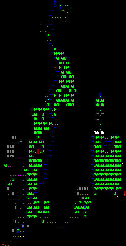
Here's a first look at my map. It's the prototype for my mud. Legends of Old. If Hades Kane would want to put his creativity on it that'd be grand, but if not then that's fine as well. Figure it is worth a try :). The black dots represent cities/villages. The bigger the dot the bigger the city.

13 Sep, 2007, Kjwah wrote in the 33rd comment:
######################
######################
######################
##########@###########
######################
######################
######################
######################
@ = You are here.
….
######################
######################
##########@###########
######################
######################
######################
######################
@ = You are here.
….
06 Oct, 2007, jjack wrote in the 34th comment:
Kjwah wins.
 Small version
23 Oct, 2007, Conner wrote in the 36th comment:
Not bad at all, HavenDuuk. :smile:
24 Oct, 2007, Zeno wrote in the 37th comment:
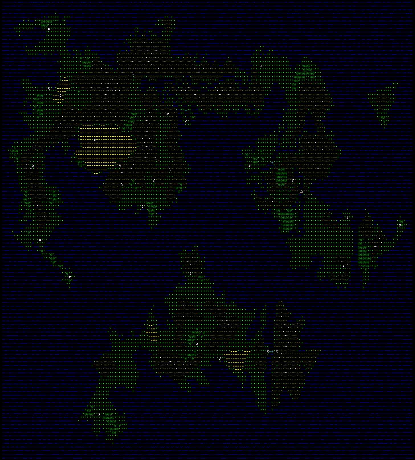
Here's a map of ground level in the feudal era.
http://img.photobucket.com/albums/v123/rebirthseph/biyg_map1.gif
Feudal Japan had quite of a bit of forests, of course. :P
Note that we're in alpha and most areas are going to be relinked when the correct linking areas are in.
http://img.photobucket.com/albums/v123/rebirthseph/biyg_map1.gif
Feudal Japan had quite of a bit of forests, of course. :P
Note that we're in alpha and most areas are going to be relinked when the correct linking areas are in.
25 Oct, 2007, Hades_Kane wrote in the 38th comment:
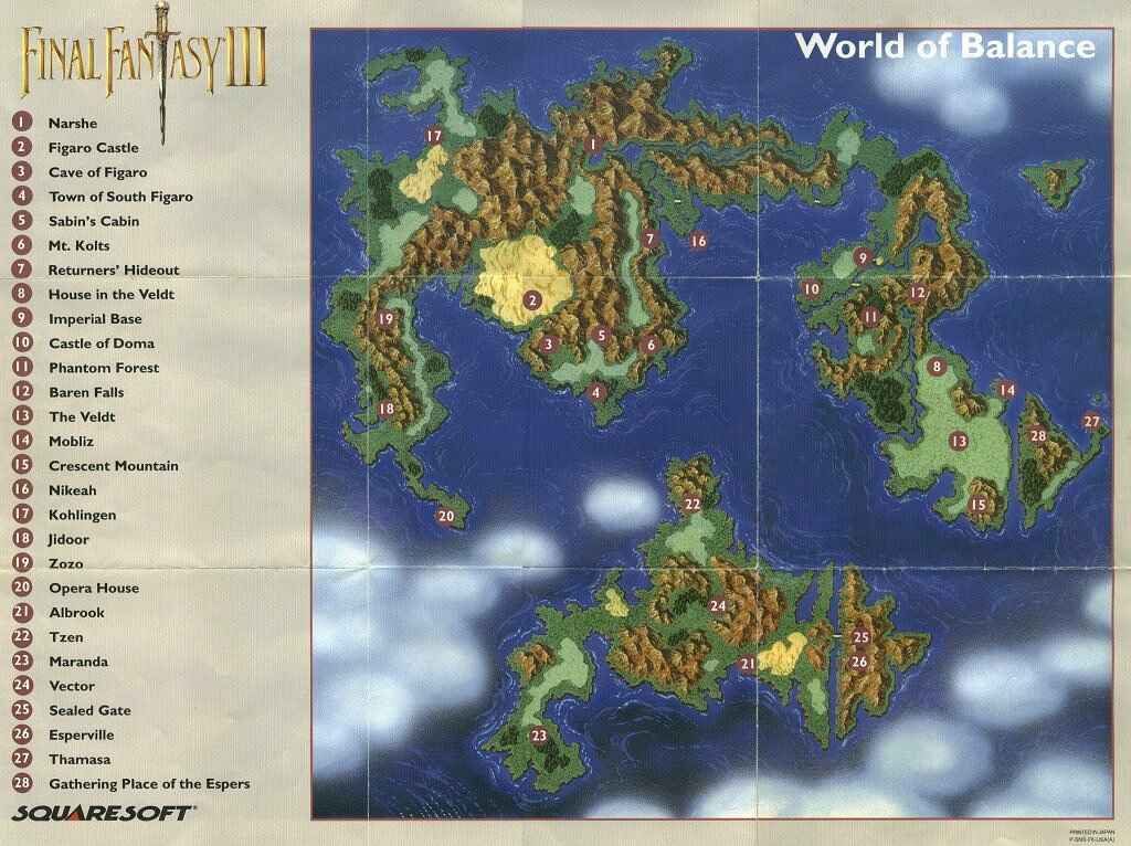
Here's a world map I made for a Final Fantasy 6 based MUD (that never went anywhere) a couple years back:
http://www.eotmud.com/ff6map.jpg
It's the FF6 "World of Balance" map.
To compare:
http://www.eyesonff.com/ff6/maps/ff6-wor...
http://www.uffsite.net/ff6/images/maps/1...
That's a large screenshot of the actual in-game map, though.
http://www.eotmud.com/ff6map.jpg
It's the FF6 "World of Balance" map.
To compare:
http://www.eyesonff.com/ff6/maps/ff6-wor...
http://www.uffsite.net/ff6/images/maps/1...
That's a large screenshot of the actual in-game map, though.
25 Oct, 2007, Conner wrote in the 39th comment:
Zeno said:
Here's a map of ground level in the feudal era.
http://img.photobucket.com/albums/v123/rebirthseph/biyg_map1.gif
Feudal Japan had quite of a bit of forests, of course. :P
Note that we're in alpha and most areas are going to be relinked when the correct linking areas are in.
http://img.photobucket.com/albums/v123/rebirthseph/biyg_map1.gif
Feudal Japan had quite of a bit of forests, of course. :P
Note that we're in alpha and most areas are going to be relinked when the correct linking areas are in.
Looks a bit like overland code to me.
Hades_Kane said:
Here's a world map I made for a Final Fantasy 6 based MUD (that never went anywhere) a couple years back:
http://www.eotmud.com/ff6map.jpg
It's the FF6 "World of Balance" map.
To compare:
http://www.eyesonff.com/ff6/maps/ff6-wor...
http://www.uffsite.net/ff6/images/maps/1...
That's a large screenshot of the actual in-game map, though.
http://www.eotmud.com/ff6map.jpg
It's the FF6 "World of Balance" map.
To compare:
http://www.eyesonff.com/ff6/maps/ff6-wor...
http://www.uffsite.net/ff6/images/maps/1...
That's a large screenshot of the actual in-game map, though.
This one also looks a bit like the overland code to me, but it does appear to match fairly close to the maps it's modeling.
Random Picks
I have conceived of a way to take my mudrooms data and generate a really simple ascii map by assigning coordinates of *'s, X's and such in a giant rectangle. But I have no idea how would one go about taking the same room data and creating a smooth-lined picture out of it. Could you please give some details about how you accomplished this?
Detah@Arcania
It's not as hard as you'd think Detah! You'll need the gdlib to do it, so make sure the server you're on has it. Then glance around the net to find code for it (I'm pretty sure it comes with the stock overland code). With the lib, not only can you auto-generate the image, but you can also read the image. I used the gdlib to allow my MUD to read a png file and load up the world based on it. So I could draw my wilderness and then let the MUD build all the rooms for me.